I own a lot of TSS 2′ square terrain tiles for my wargaming table. I wanted to use these for a campaignn system,too. So I thought about a way of cataloging and using the tiles electronically .
As I am not that good with computer graphics but use powerpoint a lot, I used that program for my needs.
The TSS tiles are 3D modular Styrofoam boards with rivers tracks etc on them. I bought quite a lot a few years ago but certain typs are still missing , wich I will build myself in the future ( expect to see a how too later).
So here is a screenshot from the tiles I did with powerpoint:
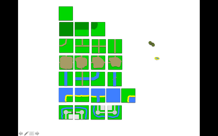
Top row just plain grasslandd, then hill contours ,roads/tracks, build up areas(to place buildings on, River tiles, Coastline and open water and last my castle .
Next I did some overlays :
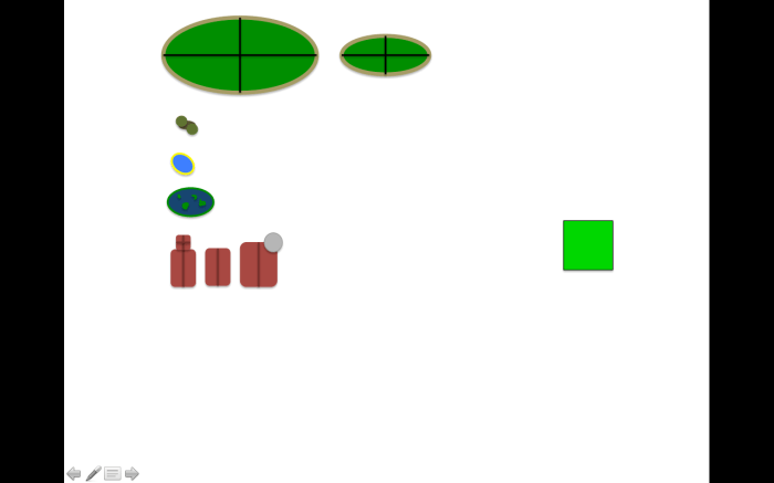
two 4 part hills, trees, a pond, a swamp, a church, a house, a manor house .
I will add other overlays and tiles when I actually have build them for my gaming table.
Here is a sample map I did with the tiles:

So when two armies meet on this campaign map ( which in this case is very small I know) it is very easy now for me to translate that onto my gaming table. The only thing I have to figure out is how to calculate movement on the campaign map in relation to movement on the table. If you have an idea please post it here!!!
The red area is the amount of tiles fitting on my gaming table ( 4×7 tiles). This red rectangular can be moved and turned around so that you exactly know what the table has to look like. Here are two more examples:


When I do more I will show the progress here . I hope this might be useful for you. I think with this approach it makes much more sense to fight for a bridge or a hamlet then just fight one of battles.
